Dan Climbs the Beehive Cliff in Acadia National Park, Maine (2023)

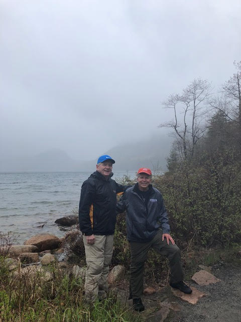
Since March, the cliff climbing trails of Acadia National Park such as the Jordan Cliffs Trail, Precipice Trail, and Valley Cove Trail have been closed to protect peregrine falcons during their annual nesting season.  I had assumed the Beehive Trail which is up the cliffside by Sand Beach would also be closed.  Bill (a University of New Hampshire friend from the Great White North (i.e. Au Canada) and I learn that this cliff trail is open and ready for business.

Thrilled, we breakfast at our go-to motel, the Bar Harbor Motel, basically across from the College of the Atlantic, with the biggest, Dan-satisfying muffins in New England and a combo half-caf.  Properly caffeinated, Bill and I look forward to a hike up the steep cliff.

Arriving at 9:30 AM to the Sand Beach parking lot, we literally get the last parking spot. (nota bene if that lot is filled, there is parking along the Park Loop Road for everyone).  With quite a few others, we cross the Park Loop Road on this first day of June 2023.

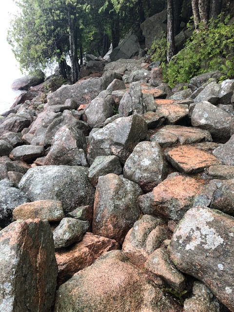
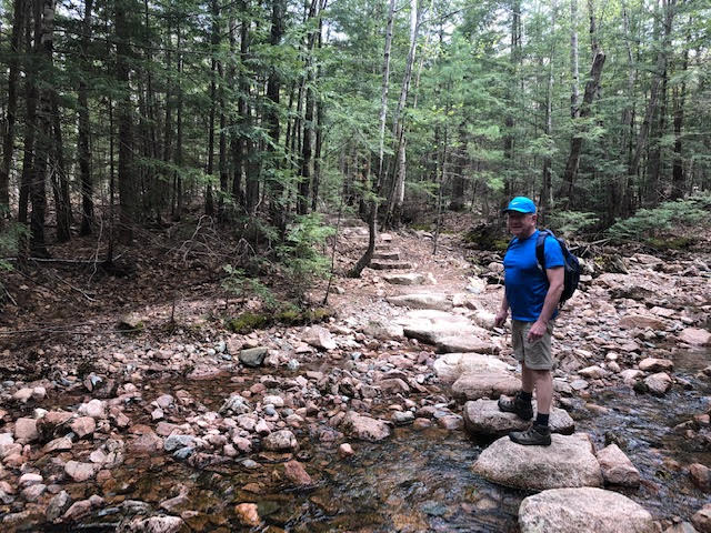
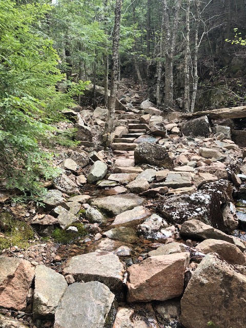
Bill as the stony trail begins into the spring green forest

The blue blazes guide us to the key trail junction

Once at the trailhead, we step lightly over the stones to the junction of the Beehive Trail and a warning.

Widen this image to read the cautions of hiking the Beehive Trail

Here we have a choice to climb up the cliff using metal rungs to attack the Beehive Trail or take the trail straight ahead to reach the summit from the backside.  Moderately fearless cliff climbers that we are, Bill and I are ready to tackle the mountain vertically.

Ingenious metal rungs along the cliff side

Solid rungs for the adventurous among us

As was the case for me at Angels Landing at Zion National Park where there were always chains when I needed one, this morning there are metal rungs whenever we need them to pull ourselves up or brace ourselves close to the mountainside.

Bill leading the way

Pausing to take in Sand Beach from on high

Sand Beach from the Beehive Trail

Though probably the most popular hike at Acadia National Park, there is no log jam on this picture-perfect 70F morning on the first of June.  Whenever necessary, Bill and I step aside for the younger among us climbing to the summit.

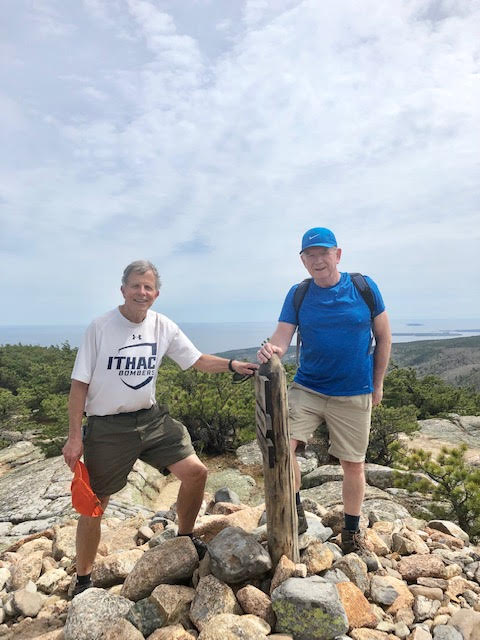
Atop Beehive Mountain with the inlet to Bar Harbor in the background

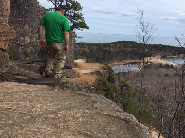
In what seems no time, we are high above Sand Beach basking in the sunshine as triumphant hikers.  Clearly, I would take our grandsons Owen (10) and Max (9) up this trail in a heartbeat if they wanted to go.  Angels Landing at Zion, a challenge the boys have met, is far more challenging.

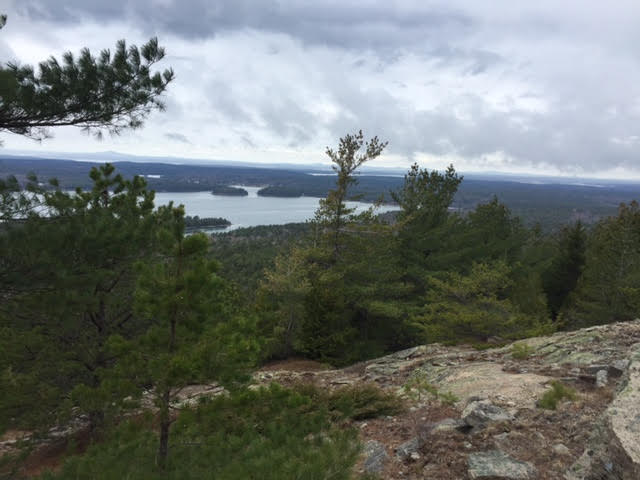
Once at the top there is a gentle descent over the mountain’s ever-present stones down to Bubble Pond where a dog splashes and others cool their feet in the waters of this mountain tarn.

Bubble Pond on the backside of Beehive Mountain

In short order we bear to the left around the mountain on the Beehive Trail loop to complete the less than two mile hike in just under two hours. 

The loop trail on the backside of Beehive Mountain

Back at our original junction with the warning sign, we look up to see the colorful shirts of hikers on the mountains who seem to be literally hanging on to the cliffs.  It looks scarier than it is from below.  That said, it’s not a hike for the slightly or seriously acrophobic among us.

Beehive Mountain from the junction where the warning sign is

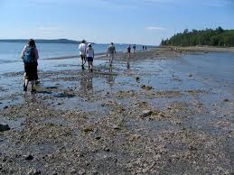
A quick walk to Sand Beach gives us the view of Beehive Mountain.  (By the way, the state of Maine has but thirteen miles of sandy beach.  Here we have 300 yards of it.  York has four sandy beaches, not quite two miles of the 13.)

Beehive Mountain from Sand Beach

Dan Hikes to the Bubble Mountains in Acadia National Park, Maine (2023)

Acadia National Park in Bar Harbor, Maine

Once spring comes to New England, it is time to schedule my annual trip to Acadia National Park with my friend Bill, the Canadian.  We go way back.  In fact, we met in 1983 at the Summer Writing Program at the University of New Hampshire.  Yearly, we each drive four hours plus or minus, he from New Brunswick, Au Canada and moi from York, Maine, to Bar Harbor for two days of hiking. 

Bill leads the way at the trailhead to the Bubble Mountains

Having endured the rock pile that is Pemetic Mountain in Acadia last spring 2022 (click here for that painful hike), Bill and I are looking to avoid the serious bouldering this time. 

Gorgeous 73F spring day on the last day of May 2023

After we park at the Bubbles lot off the Park Loop Road, I am looking for more hiking so I suggest to Bill that we take the trail left for 0.4 of a mile towards Jordan Pond. Most hikers use the more direct route to the right to approach first South Bubble, than North Bubble

Jordan Pond at the point four-tenths of a mile from the Bubbles parking lot

Soon we are at Jordan Pond, turn right for the Bubble Divide Trail.  Little do we know that we have inadvertently stumbled on another trail of boulders up a mountain.  No way can I call this hiking; it’s hands and feet clawing our way to the top.  My advice is Don’t Pass Go and Don’t Collect $200 by going this way.  Follow the signs from the parking to the right to the South and North Bubble.

Some of the many boulders on the Bubble Divide “trail”

All the rock you would ever want on the Bubbles Divide Trail

Once at the ridge line of the Bubble Mountains, we see that trail to South Bubble that we would have taken had we followed the crowd.  I know that following the crowd is frowned upon in the metaphoric and philosophical sense, but I beg to differ in this context.

Bill and Dan atop South Bubble with Eagle Lake in the background

We hike the simple 0.2 of a mile trail to the South Bubble summit with many other hikers in late May 2023.  Bubble Rock is supposed to be the big wow of this summit.   It’s fine.

Bubble Rock on South Bubble Mountain

Little did we know that a more spectacular view awaits us on North Bubble.  Again a simple 0.2 miles off the Bubbles Divide Trail is the well-marked, many granite-staired trail to the top.

Bill leading the way up Bubble North

We have a spectacular afternoon of hiking that challenges but doesn’t overwhelm. 

Jordan Pond from atop North Bubble Mountain

Once showered and rested, Bill and I sit in the grassy area near the pool at the Bar Harbor Motel with wine and cheese and crackers.  We then walk the mile and a half to Geddy’s Pub in the downtown for a grilled mushroom and green pepper pizza. 

Living the good life at Geddy’s with Bill

We toast the day and our friendship unaware that we are about to have a delightful hiking surprise tomorrow for hike #2.  That’s a tease for next week’s blog!

Dan Hikes His Favorite Trail in Acadia National Park (Maine) – the Jordan Pond Loop (2022)

Acadia National Park in green

After summiting Pemetic Mountain yesterday with my friend, the Canadian, Bill Buggie, I am ready for some lighter fare this mid-May 2022 Wednesday morning.  Click here for the Pemetic climb blog.

The Carriage Road at 6 AM on a May morning with a 5:15 AM sunrise

Prior to our three plus mile hike around Jordan Pond, I wake early at the Bar Harbor Motel for a solo morning walk on the Carriage Roads of Acadia National Park.  Among the many reasons to stay at this fine motel (one of which is the delectable muffins with coffee) is that the motel grounds connect directly to the 45 miles of Carriage Roads of Acadia.

Jordan Pond at the heart of Acadia National Park

With the sun already up at 6 AM, I have a classic Walk in the Woods (Bill Bryson) all to myself on this 46 degree morning.  Returning for the free continental breakfast at the Bar Harbor Motel, I pick up a coffee cake muffin, pour myself a cup of joe, and return to my motel room to watch Sports Center.  You got to be thinking, our boy knows how to live. Oui?

Later Bill and I meet for breakfast in the lobby of the motel and plan our hike around Jordan Pond, a hike we did three years ago.  The Covid pandemic kept us off the trails in Acadia in 2020 and 2021.

The trail begins down the lawn from the Jordan Pond House
From Jordan Pond, we see Pemetic Mountain to the right center and the North and South Bubbles to the left center.

Arriving by 930A on a windy, mid-forties overcast morning (remember it’s May in Maine!), we decide to hike the pond loop clockwise starting with the puncheons (planks of wood) above the pond-side undulating wetlands).  We have a mile of timber plank joy as we hike the east side of the pond.

The puncheons go on for nearly a mile on the east side of Jordan Pond
Bill on puncheons with turn-outs every 100′ or so for hikers coming in the opposite direction
The trail is always within feet of the pond. Bucky Beaver slipped away before we got to tell him how impressed we were with the first stages of building a dam.

After a mile, we have pond-side boulders to climb over.  This kind of bouldering is actually fun and a piece of cake as there is little elevation gain.

Bill on the easy-to-navigate boulders of Jordan Pond

At the far end of the pond, we cross a wooden bridge to an easy peezy wide-enough-for-two trail for the next mile plus.

The far end of Jordan Pond

It’s a gentle way to end our return to hiking Acadia National Park for Bill and me.

The sweet trail along the north side of Jordan Pond. Our boy sporting a pair of LL Bean zip-offs.
Like walking down main street albeit in a woodland setting

Dan Hikes the Big Bad Pemetic Mountain in Acadia National Park (Maine) – 2022

Since our days as public school teachers in the Summer Writing Program at the University of New Hampshire in 1983, my friend Bill Buggie and I have lately hiked in Acadia National Park each May.  As you might imagine, we have not done so since 2019 due to the Covid-19 pandemic.

Through much of 2020 and 2021, Bill as a Canadian was not allowed in the United States.  With restrictions lifted, he and I plan to resume our hiking tradition near Bar Harbor, Maine this May 2022.  We each live three to four hours away from the Park.  See maps below.

Bills journey of 300 miles, 3 hours 50 minutes
Dan’s journey of 210 miles, 3 hours 25 minutes

Leaving at 8 AM from York, I arrive at the Bar Harbor Motel just before noon.  The planets align and Bill pulls in one minute later.  Lunching on tuna Subway subs, we sip a fine Trader Joe’s IPA at a motel picnic table before driving twenty minutes to Jordan Pond at the heart of Acadia National Park.

Our go-to motel in Bar Harbor is within walking access to the Carriage Roads of Acadia; its the best coffee and big muffins combo in the world, well in my experience.

The Bar Harbor Motel lobster welcomes me in. Hannah and I have learned to always tip the chamber maids.

Jordan Pond is the starting point of the Pemetic Mountain Loop Trail.  In my many circumnavigations of Jordan Pond, I had seen the turn off to this mountaintop trail and imagined the four-mile up and over this 1200′ mountain as a challenge worth taking.   

Pemetic Loop trail

Little did we know what awaited us.

Our hike begins benignly at Jordan Pond on an idyllic spring afternoon in May
With bedrock just beneath the surface, we hike over roots aplenty…
…as well as exposed stone.

Acadia has a foundation of bedrock and more rocks per square inch than you can imagine.  This is no sweet-on-the-feet sandstone trail of Utah’s National Parks.  Climbing through the forest early afternoon on a mid-May 2022 Tuesday, we meet a number of descending hikers, generally retirees like we are. 

Half way up Pemetic with the harbor islands to the Atlantic Ocean in the distance
With still more exposed stone to climb

My question to those coming down the mountain, Are you hiking up and back on this trail?  They all are returning to Jordan Pond from whence they came.  No one is hiking the loop that we are.  I wonder why?  We’ll soon learn.

The trail of blue blazes to the mountaintop is well-marked and reasonably popular in the late spring without being busy at all. It’s a challenging climb not made for all, but there is little chance of getting lost.  An hour and thirty minutes later we arrive at the summit 1.7 miles from the trailhead. 

Bill, the Canadian, within meters of the summit.

At the summit of Pemetic Mountain the wind blows and I literally hold onto my hat.

Looking west toward the mainland

Now for the descent.  It’s classic Adirondack switchbacks (i.e. straight down hill).  We slide on our butts, uses our hands repeatedly to maneuver down the rock pile.  We are not climbing down, we are bouldering at its worst. Full of judgment and without a Zen bone in my body for bouldering, I endure the rocky descent.

Log stairs help us descend some of the steepest parts of the trail
Saplings for hand-holds help us descend
Bill successful navigates the steep rocky slope
I told you there were a lot of rocks, especially on the climb down

It takes us 45 minutes to boulder down a half mile to the Park Loop Road.  We are in full agreement that this is the toughest hike we’ve done in Acadia since we began hiking together in 2015.  Bar none, Bar Harbor.  And we have hiked the Beehive Trail using metal rungs to climb to the mountaintop.

From there we return to woodland hiking for a half mile to Jordan Pond.

On terra firma after the rocky descent

We stride triumphantly along Jordan Pond for nearly a mile back to the trailhead.

The path along Jordan Pond back to the trailhead

Dan Hikes Around Jordan Pond in Acadia National Park (Maine)

Jordan map

I awake before dawn in the queen bed at the Bar Harbor Motel; my friend Bill in the next room.  After yesterday afternoon’s climb up the Gorge Trail in sunshine (Click here for that posting), today’s forecast is for mist and drizzle.  It’s no morning to climb any of the rock faces of the many mountains here in Acadia.  A hike around Jordan Pond becomes an ideal trail choice.

After checking ESPN sports on my iPhone in bed, I slip into my hiking Merrell’s for an early morning walk to check out the weather and warm up on the Carriage Roads of  Acadia National Park just beyond the motel property.  A ball cap and Ithaca College jacket are enough to shed any light rain as I walk for 45 quiet minutes.

Meeting up with Bill for the motel continental breakfast later, we agree that hats and jackets will ward off any light precipitation.  Taking delectable small bites of a blueberry muffin while sipping my decafe black, I have my dose of morning nirvana.

Jordan Park Look Road

Park Loop Road in Acadia

Driving twenty minutes on the Park Loop Road, we arrive at a nearly empty parking lot at the Jordan Pond House.  Like most hikers today, we have come from away and are not going to let a little rain deter us.  Walking down the trail in front of the Jordan Pond Lodge, we are met by two unleashed, large labradoodles; I agree with our grandson Owen who likes his dogs small and not barking.

I am leery of new dogs, having been nipped and bitten before by dogs that “would never bite anyone.”  The female hikers see us, but as we approach the white demon barks wildly at us.  I step back immediately.  She says, He doesn’t like to be startled.  Ya think!  You saw us coming!  I think but don’t say.  Fortunately they head to Pemetic Mountain and we begin our circumnavigation of the pond.

Jordan 6 B and D back at start

Bill and Dan at Jordan Pond

The eastern side is a pleasant easy going, winding gravel trail within an arm’s reach of the water.  Though we see no beavers, we do see their handiwork; and, in this case, their impending triumph.

Jordan 2A beavers at work

Jordan 2 gravel trail

Jordan 2B Bill on gravel trail

My friend Bill

By the far end of the pond, we cross a man-made causeway, then a wooden bridge through the marsh and over the creek emptying into Jordan Pond.

Jordan 3 D at bridge

From here things get interesting as the granite boulders come down to the shoreline from Penobscot Mountain.  Never too difficult to climb over, the low lying rocks have an orange sheen (painted?) which guides our way.  Always within 10’ of the water, we never feel we might slip on the moisture-soaked rocks.

Jordan 4 bouldery trail

Jordan 4A more of bouldery trail

Then, for what seems like ¾ of a mile, we have a succession of planks a foot or two above the rocky, uneven terrain bordering the east side of Jordan Pond.  Though slick, the planks allow us to walk with a steady rhythm back towards the lodge.

Jordan 5 plank trail

Jordan 5A more planks with D

Jordan 5C newer planks

Two couples from Ontario, Au Canada and parents of a darting up and down the planks five year old boy with his three-year old sister brighten the morning as the drizzle ends.  With parents like these, these kids will grow up not letting a little inclement weather deter them from getting a healthy dose of Vitamin N (i.e. Nature).

Jordan 6A D and B again at end

Misty morning in Acadia (Jordan Pond)

Dan Hikes the Gorge Trail in Acadia National Park (Maine)

Gorge map

York is to the east of Portsmouth.  Notice how much of Maine lies north of Bangor.

Looking to break up my 215-mile drive from our home in York to Bar Harbor at the gateway to Acadia National Park, I stop off at the Armstrong Tennis Center in Bangor to play pickleball with these central Maine “experienced” players.

At the indoor courts, the cacophony of whacking plastic “wiffle balls” fills six pickleball courts is sweet music to my ears.  Within five minutes I am in a game of doubles with Lisa as my partner v. Mark and Doug.  “Experienced” enough to give them a decent game, I have just the pause from the road that I wanted after two hours of steady play.

Driving on an hour to Bar Harbor, I am primed for an afternoon of hiking with the Canadian, my friend Bill Buggie of New Brunswick, from our days at the University of New Hampshire.

Arriving at the Bar Harbor Motel just after noon, I chat up the hospitality worker, Kim.  In response to my question about hiking, she suggests the Gorge Trail, a family favorite.  On a sunny afternoon near 70F, it’s an ideal 2-3 hour hiking choice for the two of us, who coincidentally, are on either side of 70 ourselves.

Taking the Park Loop road, I squeeze my Toyota Prius into roadside parking for five vehicles.  Being the Thursday before Memorial Day Weekend, and still not in-season, we are ready for an afternoon dose of Vitamin N (i.e. Nature).

Crossing a small creek, we hike 0.2 of a mile to the Gorge Trail itself.  For ten minutes we have the sweet level dirt that allows us to walk side-by-side, catching up on our lives as “give it our best shot” parents, long-time husbands, quasi-athletes, and former classroom teachers.

Gorge 1 B on gorge trail

Bill creek crossing on the Gorge Trail

Gorge 1AA D on stones on gorge trail

Dan hiking in shorts and an IC tee shirt on the Gorge Trail

Skirting the Gorge Creek for nearly a mile, we hike the very manageable rocky assent that will lead us to Dorr Mountain.  Crossing the creek multiple times, we have granite steps of master trail builders at our disposal most every footstep of the way.  The climb through the gorge comfortably warms us as the ascent is never strenuous or risky.

Gorge 1A mini-falls on gorge trail

Eight foot cascade tumbling down the Gorge Creek


Gorge 1B steps of gorge trail

The artistic and functional steps of the Gorge Trail

Gorge 1C D on gorge trail

The mostly functional Gorge Trail hiker on a trail that was not as difficult as this picture makes it seem.

Reaching the intersection on this well-marked trail, we have Option A of scrambling up the steep and boulder-y Cadillac Mountain, a truly nasty skyward climb.  No fools, we choose Option B, the less severe mountainside to Dorr Mountain.  Slow and steady with some hand climbing, we summit guided by mountaintop cairns (piled rocks to mark the trail).

Gorge 2 stones to Mt Dorr

The less severe mountainside to Dorr Mountain

Gorge 2A view to Cadillac Mt

Looking to Cadillac Mountain from Dorr Mountain.  By the way, Cadillac Mountain is the first land in the continental United States that the rising sun shines on each morning.

Gorge 2B D and B on Mt Dorr

Billy and Danny on Dorr Mountain with the Atlantic Ocean in the background

Taking the North Ridge Trail down the rocky crag, we have sloping rock faces for ¾ of mile that have us shortening our stride and cramming our toes into the front end of our hiking boots.  As the heroes you know us to be, we just tough it out.

Gorge 3 smooth stones in descent

The toe crunching descent from Dorr Mountain


Gorge 3A B on descent

And the rocky descent coming down from Dorr Mountain

Completing this three mile loop in just over two hours, we are ready to chill with our game of choice (Scrabble) and our Robert Mondavi wine of choice (bourbon barrell cabernet).

Topping off our day in this Atlantic paradise, we walk a mile and a half into town to Geddy’s, where we celebrate a mountain well-climbed with their primo Burrito Grande.  (You may be thinking, Dan, no seafood in this coastal town?  I’ve got to say I’m not a fan of le lobstere or les clams.  My roots in Arizona have me pining for Mexican food any time I can get it.)

Gorge 4 Geddy's


Dan Learns about the Bar in Bar Harbor at Acadia National Park

Acadia map of BH

Bar Harbor, home of Acadia National Park

This is a two parter.  First is for those looking for light hiking in the town.  Second is a recommendation where to stay in Bar Harbor.

Located in Downeast Maine, Bar Harbor is pronounced “Bah Hahbah” by Mainers and playfully by those from “away.”  “Downeast” often refers to the eastern coast of Maine.  The phrase derives from sailing terminology: sailors from western ports sailed downwind to the east to reach this area.

Bar 4A B and D summit better

Dan with his Canadian buddy, Bill Buggie

With my UNH college friend, Bill Buggie, I have come to discover the bar in Bar Harbor.  On previous hiking and biking trips to Acadia National Park on Mount Desert Island, we have heard the story that at low tide the sand bar magically appears so walkers, even cars, can cross to Bar Island itself.

Bar 4C Bar Harbor from BI summit

The view of Bar Harbor from Bar Island

Coming during the first week of May, Bill and I have the town to ourselves.  Last night we immediately got a table at Geddy’s in the heart of the downtown at the prime dining hour of 7P.  Parking last night, and now this next Monday morning, is plentiful as we prepare to walk the land bridge to Bar Island at low tide.

Bar 1AB high tide 2

From Bar Harbor to Bar Island at high tide

Having checked the tide charts for Bar Harbor weeks before, we know that this Monday morning at 11A is the lowest of low tides.  The park service advertises that there is a three hour window to hike to the island and be back before the salt waters of high tide rule the day.  Descending Bridge Street, we have a land bridge from the harbor to Bar Island.  Hence, the street name.


Bar 1A D at land bridge

In fact, the sandbar to Bar Island is mostly a gravel bar and could easily support a four-wheel vehicle.  As Bill and I arrive at 930A, we see people already walking to the island.  Hoping we’d see the tide receding slowly to expose the land bridge, something out of Charlton Heston crossing the Red Sea in the Ten Commandments, I am mildly disappointed that the sand/gravel trail is already over 100’ wide, and obviously easy to cross.

Bar 1B wide land bridge

Monday morning at 930A, low tide

Stepping first among the small stones of the gravel bar, we soon close in on the island over large smooth stones with an obvious trail before us.  The trail through the forest and meadows is well-marked and ten to twenty other walkers make it clear the way to go.  Once on Bar Island, hiking to the modest summit takes us a leisurely fifteen minutes.  Looking back to Bar Harbor itself, we know we have found a family hike that kids under ten can easily do.

Bar 2 sign 2

Bar 2A submerged cars

Bar 3 trail begins

Bar 3A trail to summit


Bar map of shore path with BI

The Shore Path in red (the dotted line is the land bridge to Bar Island)

With only an hour of hiking/walking under our belts, we head to the Shore Path that goes from the downtown park at the Bar Harbor Inn, and then along the harbor waterfront past high priced condos and estates of old money.  It’s a delightful level walk of less than a mile with islands dotting the harbor for our viewing pleasure.

Bar 5 B and D on shore path

Bill and Dan on Bar Harbor’s Shore Path


Bonus section is for folks wondering about a recommendation where to stay in Bar Harbor.

Ever wonder where to stay in Bar Harbor when some hotel rooms in season go for north of $400 to $500?  Wonder no more.

First, let’s back up.  Consider traveling to Bar Harbor in May.  Tourist season that once went from Memorial Day to Labor Day now stretches into September and October.  Come November, the dark of 415P sunsets makes this the fishing village that the locals love.

bar acadia park inn sign

On this first Sunday night of May, Bill and I each have a room at the Best Western Acadia Park Inn for $99 a night; in August the same room is $209, in September $189, and after Columbus Day weekend in October $135.

Let me take you back to our daybreak feast.

It’s Monday morning, I slip into the large dining area at 630A to be greeted by Jill, a downhome down easterner of perpetual joy.  Toasting an English muffin and pouring myself a full 12 ounces of dynamite decaf, I return to my room to luxuriate with Sports Center.  Once done, I’m not done!  I return for a second cup with a banana nut muffin that I warm to mouth-watering perfection in the in-room microwave.  And that’s just the beginning.

Bar API breakfast room

At 8A when Bill and I have arranged to meet for breakfast, I take breakfast to the next level.  Ladling out primo Quaker oatmeal from an 18″ coffee urn size container, I then sprinkle on raisins and walnuts.  The oatmeal is so tantalizing that I forego the eggs and sausage to have another bowl of oatmeal for our morning of hiking.

This oatmellian delight compares favorably with the oatmeal that Hannah and I have every morning when we are home.  As if things couldn’t get any better, I top off breakfast with hash brown mini-patties, be they doused with salsa (a personal favorite) or delectably savored alone.  You can’t go wrong with the Acadia Park Inn.

Dan Hikes a Three-pack of Mountains (Bald, Parkman, and Gilmore) in Acadia National Park

Acadia map of BH

For a fourth time in the past three years, I drive north the 3+ hours from our home in York to Acadia National Park to meet up with Bill Buggie, my UNH buddy from Canada, for two days of hiking.  Back in 1983, Bill and I met on the campus of the University of New Hampshire as students in the New Hampshire Summer Writing Program and we’ve been amigos ever since.

Bar 4A B and D summit better

Arriving at our rendezvous at the Best Western Acadia Park Inn in Bar Harbor just after noon this first Sunday in May, we are not deterred by the intermittent raindrops.  Having come to hike early in the season, we are not dissuaded from hiking this afternoon, on trails that will not be swarming with other hikers.

As we approach the ranger at the Hull Cove Visitor Center for a hiking suggestion, we spread out our $5 trail map and see that his name is Sardius Stalker.  I ask if his first name is Greek.  He smiles and says that that is what he initially thought but later learned it was Latin.  He explains that Sardius is a ruby in the breastplate of a Jewish high priest mentioned in Exodus in the Bible.  I was not going to make a crack about his last name.

Noting our map with the yellow highlighted trails of previous hikes to Acadia that Bill and I did together, he says, I see you like strenuous hikes.  He suggests a trio of balds (mountain tops with no trees) for our hiking pleasure – Bald, Parkman, and Gilmore Mountains.

Acadia 1 D at sign

Having a trail that fits our desire to hike for two to three hours, we leave the visitor center and take the obligatory picture by the Acadia National Park sign.  Traveling on the Park Loop Road, we turn on to route 233 heading away from town, past the Mount Desert Island High School.  Route 233 tees at route 198, which we turn left on and drive a half mile to a parking area off to the right near the Norumbega Trail.

Acadia 1D B on rocky rooted trail

Crossing the highway and taking to the forested trail in tee shirt and shorts on this 60F afternoon, I start my hike with Bill in conversation about Lexulous, an online variation of Scrabble that we have played over the last eight years.  As word tile aficionados, we talk about strategies, when to swap tiles and if there is ever a time not to play a bingo (a 40 point bonus for using seven tiles in one play).

Acadia 1E rocky trail to Bald

It is soon apparent that our day of hiking will be one of rock climbing over stones and small boulders.  Stepping carefully in many places, we never find it perilous as we climb towards the summit of Bald Mountain at 948’ above sea level.

Acadia 1F D on rocks to Bald

Though the light rain sprinkles now and again, we are able to negotiate the mini-boulders quite easily.  In heavier rain, the conditions on the trail would be treacherous.  Falling or slipping on these unforgiving rocks could send either one of us to the ER.  We would neither pass go nor collect $200.

Acadia 1J D at Bald summit better

Atop Bald Mountain with Parkman Mountain in the background

A mere month ago these trails were covered with snow as four March nor’easters clobbered the coast of Maine; then a cold, cold April kept the snow around with all the persistence a smoker’s hacking cough.  The bright blue blazes in addition to the cairns (piled stones) expertly guide us to the summit.

Acadia 3A D on rooted trail

Summiting Bald Mountain after a one mile climb, we can see the short distance to Parkman Mountain to the northeast and Gilmore Mountain to the northwest.

Acadia 1 B descending Bald

Dipping down into the valley from Bald to Parkman, we have just 0.3 of a mile to our next summit.  The stony climb down over unforgiving granite has us stepping carefully, but it’s not impossibly difficult at all.  That said, this is not a hike for kids.

Acadia 3 rocks to Gilmore

On the Parkman summit, we have a wide view of the coastal inlands, ponds, and lakes.  Mist gets our attention and we move along purposefully, not certain what Mother Nature has in store for us.

Acadia 3C D at top of Gilmore with Bald and Parkman in the distance

Atop Gilmore with Bald to my right and Parkman to my left

Descending into the valley between Parkman and Gilmore again requires careful stepping down the granite trail of stones and boulders.  One slip and it’s sayonara, but we carefully grab the stones and nearby saplings and descend without incident.  Once atop Gilmore, we stand on the rock pile summit with Bald and Parkman summits to either side.

Acadia 4B along the maple springs trail

Along Maple Springs Creek

From Gilmore, the Spring Maple Trail follows the creek down the mountain towards the trailhead.  As it’s springtime, the creek quietly flows over granite stones making shallow pools and mini-waterfalls of the two to three feet variety.

Acadia 4 Maple springs trail

With the creek to the left, the massive boulder seemingly blocks our passage down the Spring Maple Trail

Then suddenly, the creek tumbles twenty dramatic feet away with a massive 20’+ boulder lying in our path; there is no way in hell that we are walking down the creek any further.  With no blue blaze suggesting what we do, we head uneasily on a trail where the sign says we are heading back toward Parkman Mountain.

With an inner sense that this can’t be right, we check our map and conclude there must be a way down this twenty foot cliff.  Exploring and poking around the enormous boulder, I see that indeed the trail makers have placed steps of stones around the massive stoneness allowing us to skirt the falls.  Peace returns to the valley.

Acadia 5A D at waterfalls better

As we cross under the Carriage Road bridge, we have been told of a waterfall above, not two hundred yards away on the Carriage Road itself.  Having passed these falls two Septembers ago when it was a trickle, Bill and I are pleased to find a modest flow this spring.  The picture to the right makes it apparent we need some selfie picture-taking lessons.

Acadia 5B B and D selfie


Hiking up and down this trio of mountains for three miles, we return to the trail head two and a half hours later, having never seen another hiker on this spring Sunday.  Though I like trails with others hiking, today’s time with just Bill is just about perfect.

Dan Bikes the “Around the Mountain” Loop at Acadia National Park

As a student teacher in fifth grade in the spring of 1970, I would walk from my Irish Hall dorm on the campus of Arizona State University to Mitchell School in Tempe, maybe a distance of a mile.  I had no car and it was always sunny.  I literally mean, it was always sunny for the entire semester in the Desert Southwest that spring semester.  Our students had outside recess EVERY day.

ATM phoenix temp

As ones who lived for ten years in the Valley of the Sun (Phoenix Metro area), Hannah and I were used to a steady diet of 100+F degree days from the first of May until October.   Day in and day out for those five months, we could count on lows in the 80s or 90s and highs always above 100F, often well above.  It was not pretty.  The summer weather is as consistent in the Southwest desert as a Steph Curry three pointer.

Weather consistency is not the case in our adopted state of Maine.  Yesterday my UNH college buddy, Bill and I climbed the Beehive Trail at Acadia National Park in shorts and tee shirts in 68F of delightfulness.  (See the list of categories to the left of the blog, click on Acadia National Park, and voila yesterday’s Beehive hiking blog will appear.)

ATM 1  B at Jordan Pond

Bill from Au Canada at Jordan Pond as our ride begins

This late April morning Bill and I wake in Bar Harbor to light rain with a freshening wind that puts a chill in the air.  Welcome to the variability of Maine weather as today I will bike on the Carriage Roads of Acadia National Park on Mount Desert Island in zipoff pants, heavy sweatshirt beneath my jacket with Thinsulate gloves.

ATM 3D  more of CR higher up

Carriage Road of Acadia National Park

Leaving our Best Western Acadia Park Inn after the morning rain abates at 930A, we drive the Park Loop Road past Eagle Lake and Jordan Pond without seeing another car.   Though National Park Service has added parking to the Jordan Pond area, we have no problem finding a parking spot right in front of the classic Jordan House this preseason April.

ATM 2 D with ATM sign

Bundled up in late April

Unloading the bikes, Bill and I bundle up against the cold.  Within two hundred yards, we are pedaling on the Carriage Road towards Jordan Pond itself.  The downhill coasting we do at the outset belies what awaits us as we soon will make our way around the mountain.

ATM 3 Jordan Pond from CR

Jordan Pond from the Carriage Road

Paralleling Jordan Pond on the road, we ride side by side on the 16-foot-wide hard packed gravel Carriage Road with a steady climb.  What must be annoying for Bill, I stop to take pictures as he pedals on.  As a Canadian, he fits all the stereotypes: he’s a genuinely good guy, understanding, thoughtful, not full of himself, and he knows I’ll eventually catch up.

The signage is excellent for the Carriage Roads and especially for the “Around the Mountain” (i.e., Sargent Mountain) Loop that we will take.  At sign marker 10, we head left and begin to climb as our pedaling becomes more labored.  Thank heaven for my 21 gears and a winter of rocking the recumbent bike at our Coastal Fitness gym.

ATM 3A  Bill with bikes higher up

Mountain Bill on the far side of the mountain

As a steady, slow grind up the mountain, our conversation ceases. The name of the trail is “Around the M0untain,” but we become mountain climbers this still chilly morning.  Soon my body produces heat as if I’m fueling a 1800s locomotive up over the Rockies; in time I de-bike and pack my jacket on my bike rack.

The day is raw and overcast with sprinkles here and light rain there as we are high above Frenchman’s Bay.  But there is no getting around the beauty of the setting, especially without the chaos of the summer season.

Justly rewarded with a downhill, I ride the brakes lightly as the hard packed gravel is, well, still gravelly and could give way with a quick turn.  We pass an athletic female runner with a Camelback water bag, then later a mountain racer zips by leaving us in the dust.

ATM 3C  view to inlet to the south

Somes Sound

The winding trail takes us high above Somes Sound with views to the mountains to the south and the Atlantic Ocean to the east.  Descending easily on this dream ride, I put my gloves and jacket back on.  Passing over many of Rockefeller’s stone bridges made from local granite, we later learn that the park has sixteen Carriage Road bridges that cross ravines or the motor routes through the park.

ATM 4B  D at waterfall again

Waterfall of Waterfall Bridge (look hard, it’s there)

Soon we come upon another bridge and hear voices.  Stopping to investigate, we spot the waterfall at the appropriately named Waterfall Bridge.   Built in 1925, the Waterfall Bridge, which spans Hadlock Brook, is 125 feet in length and flares at the ends. A pair of viewing platforms jut out on either side to take advantage of the view.

ATM 4C  selfie of B and D

Selfie of two UNH Wildcats at the waterfall

Upon returning to the Jordan House parking lot, we have had a 20 kilometer (12 miles American) ride “Around the Mountain” at a slow and steady pace over the past nearly two hours of spring chill on the coast of Maine.  Finished with our ride, we head into town to explore and perhaps discover why the town is called Bar Harbor.  And soon we will indeed find out why.

ATM looking from bridge street

The view from Bridge Street in Bar Harbor to Bar Island

Seeing on our Acadia National Park Hiking and Biking Trail Map ($4.95 at the Visitor Center) that there is a trail from town to Bar Island just off shore, we work our way to Bridge Street. There we see a concrete ramp sloping into the bay, with Bar Island, maybe 400 yards in the distance.  The tide is in and there is no way we are crossing without a boat.  What gives?  Where the h is the trail?

ATM  bar island road

The rocky sand bar from Bar Harbor to Bar Island

Fortunately, an Anglo Rastafarian (perhaps I’ve jumped to that conclusion because he has dreadlocks) comes by and notices our perplexity.  He tells us that for an hour and a half or two on either side of low tide, there is indeed a road to Bar Island that cars and walkers can cross.   But once the tide comes in, one is stuck on the island for 8+ hours unless one wants to wade through what must be 40-degree water today.

Once called Eden, the town’s name was changed to Bar Harbor in 1918 because of the sand bar that goes to Bar Island.  Bill and I light up with the possibility of exploring this island when we next visit; ever mindful of the low and high tides.

Dan Climbs the Beehive Trail at Acadia National Park

Bee trust

Fear and trust.  It’s time to leave the former for the latter.  I mean, how is fear working for you?  We all have choices.  The transition from fear to trust and faith begins by believing.  Each morning I read through my affirmations.  The very first one is This is the best time in my life as I am more trusting and have greater faith.  Trusting has taken a boatload of practice for me to make it come more naturally.   In dealing with challenges, be they with people, situations, or physical, trusting in myself has made all the difference.

Bee mountain image

Beehive Mountain at Acadia National Park

Coming north from our home in York, Maine to Acadia National Park, I am ready to trust and face my one-time belief that climbing the Beehive Trail was beyond me; too risky, too too.  With its vertical rungs of rebars, the Beehive Trail, I imagined, was for those far more adventurous than I.

Bee mountain lightning

People may point to the fact that a young woman died climbing a similar vertical park hike (Precipice Trail) in 2012.  So?   Hundreds, thousands have successfully climbed the Beehive Trail.   Why make an outlier a guide for life?   Another of my morning affirmations (really my philosophy of life) is I don’t assume lightning will strike when I make decisions.

Bee map of MDI

MDI, home to Acadia National Park along the coast of Maine

The small crack to trust that I could climb the Beehive Trail was born on Angel’s Landing in Utah.  If I could climb that peak in Zion National Park, why not the Beehive Trail?

Bee ANP sign

With Hannah away with girlfriends in Vermont this late April weekend, my University of New Hampshire classmate, Bill Buggie, returns with me to Acadia National Park.   We have made a tradition of coming to Acadia before the hectic tourist summer season to hike its trails and bike its Carriage Roads.

Bee 1C  warning sign

This sign greets all climbers of the Beehive

At the Hull’s Cove Visitor Center, the young rangers show us on our trail map where to park at the trailhead by Sand Beach.  With their yellow highlighter, they outline the route to the top, the way to the Bowl (a mountain tarn/pond), and the hike over Gorham Mountain; they then take us back to Sand Beach to complete five-miles on the trail.

Parking at Sand Beach this late April Friday, we easily find the access to the Beehive Trail off the Park Loop Road.   Different from gentle sandstone trails that Hannah and I’ve encountered at Zion or the Grand Canyon, this trail is rocks upon rocks without end Amen; jagged and everywhere.  For the first two tenths of a mile the hike/climb rises gradually as we pass our first hikers coming down from the summit.

Bee 1B  Mt in distance

On the rocky trail with the Beehive in the distance

It’s a family with a ten-year-old girl and her eight-year-old brother.   Engaging the dad in conversation, I learn that though their daughter had some fear of heights, she handled the Beehive just fine.

Two hundred yards later, we meet up with another family who had taken the more leisurely roundabout Bowl Trail to the top of Beehive Mountain.   (Point of fact, there are no bees today, but the mountain in the distance does resemble a beehive.)    Unseasonably warm at 68F, the day has me in my Ithaca Bomber tee shirt and shorts.

Bee 2 Bill on rocky trail

Bill on his way up the Beehive with the trail marked by a blue blaze

In the distance, we can see the mountain top through the trees that are still not leafed out.  Above us there is a woman on the mountainside, crossing a grate between two stony ledges.   Though it’s a little bit unsettling to realize that that is where we’ll be going, Bill leads as I follow in a “No Doubt” state of mine.

The first rungs into the mountainside take us up a modest stone facade.   The rebars are immovable and reassuringly solid in a favorite uncle sort of way.   I think to myself, The steep cliffs must lie ahead.

Bee 2C  B on rocky ledge

Bill on the grate that we saw from below

Pulling ourselves up with the support of the rebars, we also have stretches of stony paths along the mountainside.   One misconception of mine of the Beehive Trail was that the rebars were all in the form of rectangular steps straight up the mountainside.  Not so, for some are clearly for handholds.

Bee 2A  D on overlook

On a brief break with Frenchman’s Bay in the distance

Climbing on, we expect that the steep section of the climb must still be ahead.  We do walk across a well-placed rebar grate between two massive stone outcroppings where we previously saw the woman. It’s more cool than scary as we walk as close as we can to the mountain wall of stone.  It never feels daunting, but that said, I don’t look down to the forest below.  Finding another flat section, we check out the view to Frenchman’s Bay and Bar Harbor itself.

Bee 3A  B climbing rungs

The climb gets serious

Soon we have a set of ten rebars to negotiate up the mountainside.  It still doesn’t feel like I am on the edge of anything.  I am just climbing the side of the mountain without a thought to the forest below.

Bee 4 B and D on top

Ahead is a mom being supported, and encouraged by her husband as their middle school age kids climb ahead.

I’m not sure how close to the top we are when we see four twenty-somethings chilling and checking out the bay below.   And then it hits us, we have summited.

Bee map of trail

I must say I’m a little disappointed.  I thought there would be a more harrowing section to show my courage and fearlessness.   We made it, but I wanted more.

The Beehive Trail is no Angel’s Landing nor Picacho Peak in Arizona.  It’s cool but doable for many hikers of many ages who don not have an excessive fear of heights.   It is always good to remember that Your safety is your responsibility.

The YouTube videos that I watched before the climb made it seem scarier than it was for me.

Bee 5 Bowl Pond

Over the Beehive to Bowl Pond

Accepting that the Beehive Trail is what it is and grateful for being on a mountain on the coast of Maine in early spring, Bill and I head off to the Bowl as part of our five miles of hiking.  Through the forest, we hike easily to and over Gorham Mountain.   Down at the Gorham Mountain trailhead, we cross over the Park Loop Road to walk along the shoreline trail on a still warm late Friday afternoon in April.

Bee 6 D on trail to Gorham Mt

The trail to Gorham Mountain

Once back at Sand Beach, Bill and I celebrate a warm hiking afternoon in Maine, and look forward this fall to when we’ll hike the companion mountainside climb, the Precipice Trail.  I hear it’s the Big Brother to the Little Brother Beehive.  We’d like to hang another pelt on our wall.